Southwest US National Parks
[Home ]
> [SW US National Parks]
[1998 Inter-Tribal Ceremonial]
Click on the photo to see a larger image.
Karen and I used to live in the Southwest US and have made many visits to the national parks there. I've got lots of photographs in boxes, but only in the last few years have I been scanning them. For me, there are two great reasons to keep going back, photography and Southwestern food, which is different from the Tex-Mex or Cal-Mex served in Texas and in "Mexican" Restaurants around the world.
Bryce Canyon National Park
|
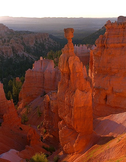
Bryce canyon is filled with tall column formations known locally as "hoodoo's". They are a result of a hard top rock layer over a softer layer. The softer layer erodes and undermines the top layer. The red color is real, the result of iron and other minerals in the rock.
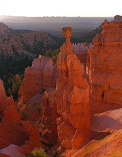
Thor's Hammer at sunrise.
|
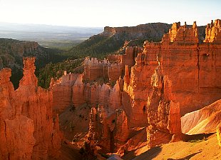
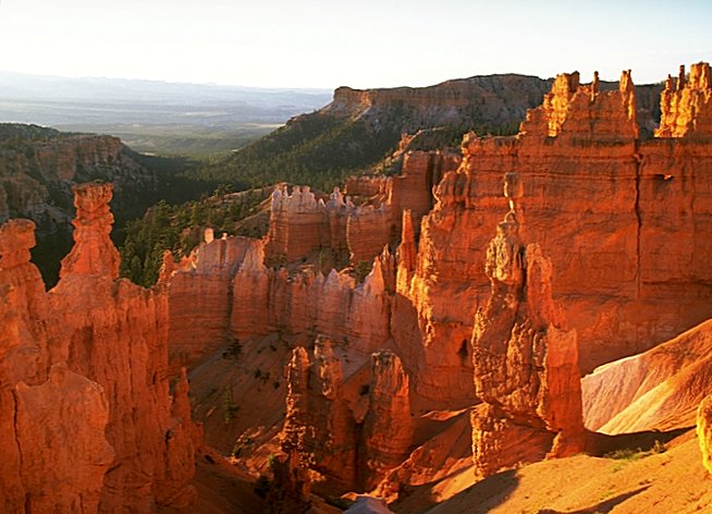
Just a few hoodoo's, there are many more.
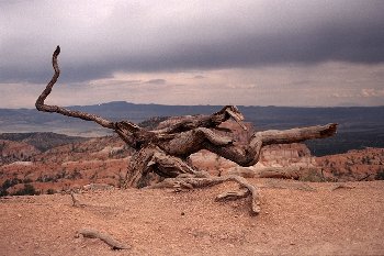
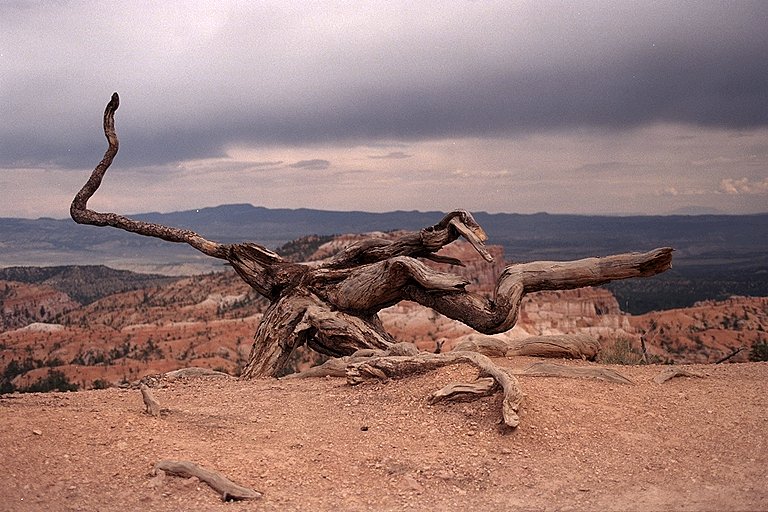
Weathered tree stump on the canyon rim.
|
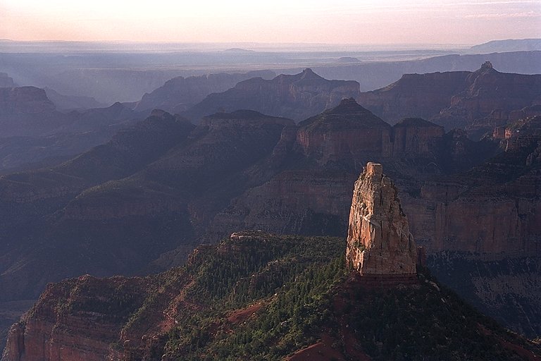
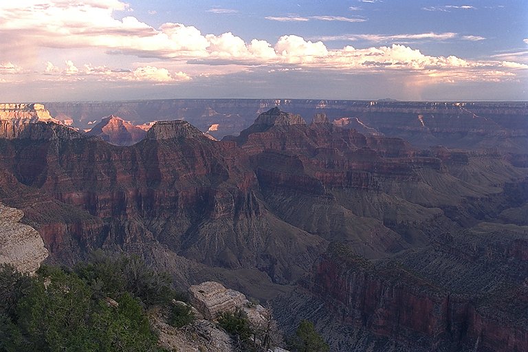
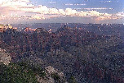
Grand Canyon National Park (North Rim)
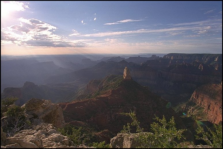
The Grand Canyon defies description, either verbally or by photographs. It is unbelieveably awesome. The North Rim is quieter and less visited than the South Rim because of the more difficult access. The drainage on the Colorado Plateau is generally North to South, so the South Rim is steeper and more visually spectacular, because the water drains away from the rim, reducing erosion. The slope of the canyon from the North Rim to the bottom is more gradual.
Because the North Rim is at about 1000 feet higher elevation than the South Rim, it is cooler and less desert-like. It has snow longer and spruce and fir trees grow there. The North Rim is closed from October to May because of snow blocking the access road.
These photos were taken at sunrise (Karen thinks I am crazy to get up early on vacation).
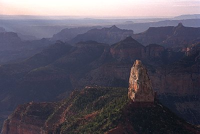
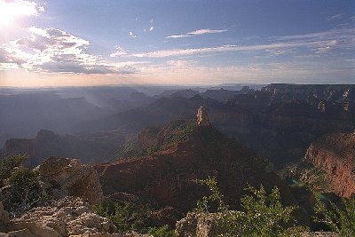
Two views of Mt. Hayden, shot from Point Imperial.
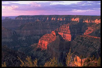
From Point Imperial looking West at sunrise.
Sunrise shot from around Bright Angel Point which is close to the North Rim Lodge.
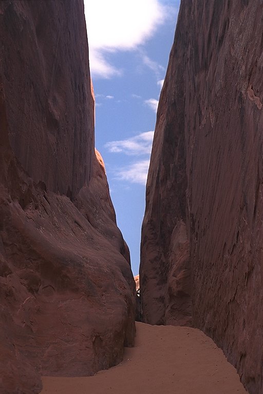
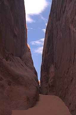
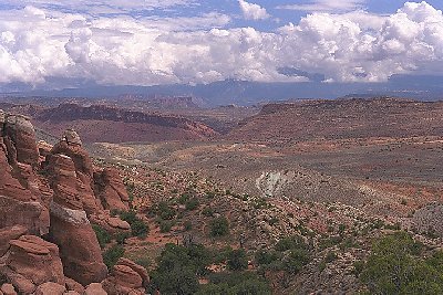
Arches National Park
|
The rock at Arches National Park had vertical joints that cause it to form vertical fins. Erosion will separate the fins, then when a gap erodes near the bottom of a fin, an arch starts to form. Next time I'm there, I'll have to try to get a good photo of an arch.
|
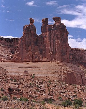
The Penguins.
|
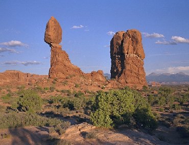
Called "Balanced Rock". They must have been right, I waited a while, but it didn't fall.
|
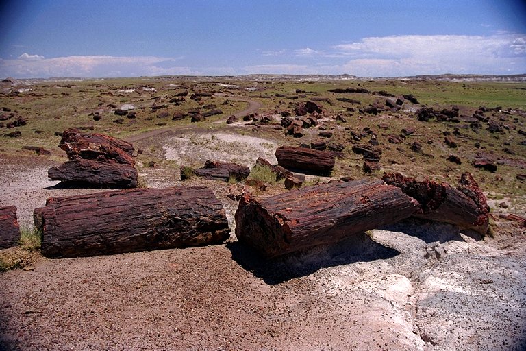
Petrified Forest National Park
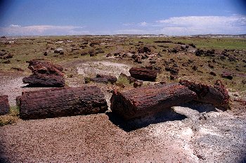
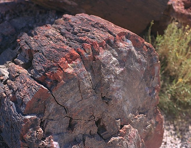
Petrified wood starts out as a real wood tree which is prevented from rotting after it falls by lack of water or being covered by mud which seals out the oxygen. Over thousands of years, the wood tissue is replaced by minerals and the tree becomes a fossil. As can be seen in the close-up of the end of a log, the minerals show every detail of the tree, although the colors depend on then mineral composition.
At the visitor's center are polished sections through huge logs, it's easy to count the growth rings. In my grandfather's time, souvenier vendors used to collect and break up the logs to sell.

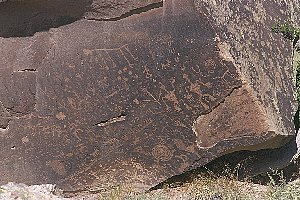
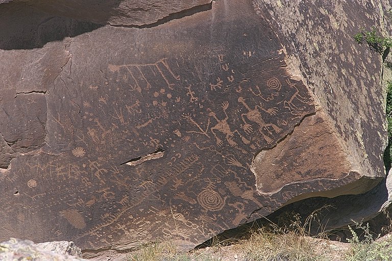
The prehistoric Americans left their comments also.
|
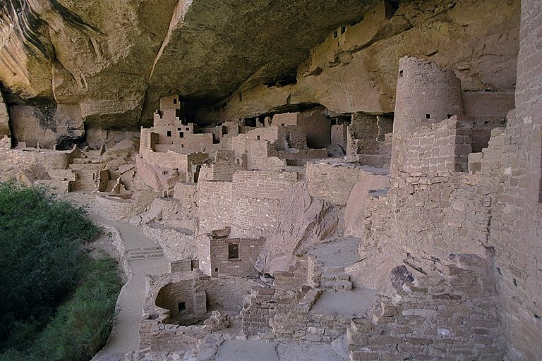
Mesa Verde National Park
|
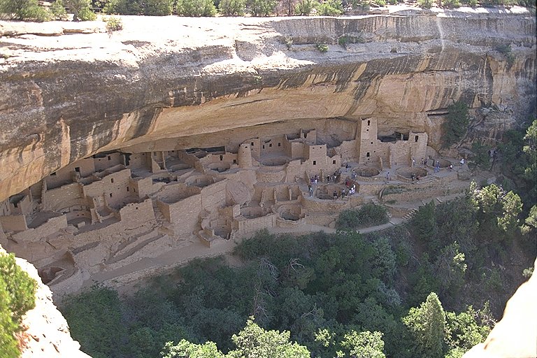
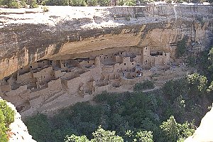
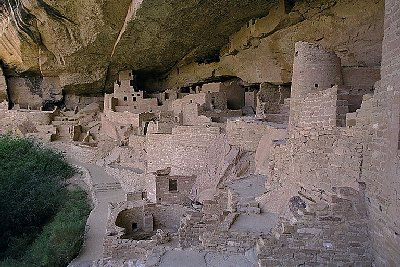
Cliff Palace in Mesa Verde. Abandoned by its inhabitants in the 1200's it's one of the best preserved cliff dwellings in North America. Some believe that it has been over-reconstructed by archeologists and the NPS.
Apparently the Indians in the area consider Cliff Palace to have special significance, they periodically ask the NPS to clear out and let them use it for ceremonial activities.
|
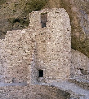
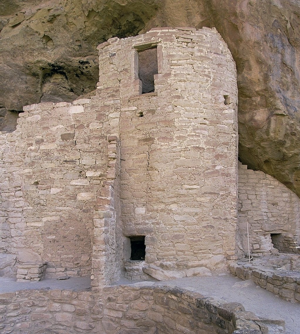
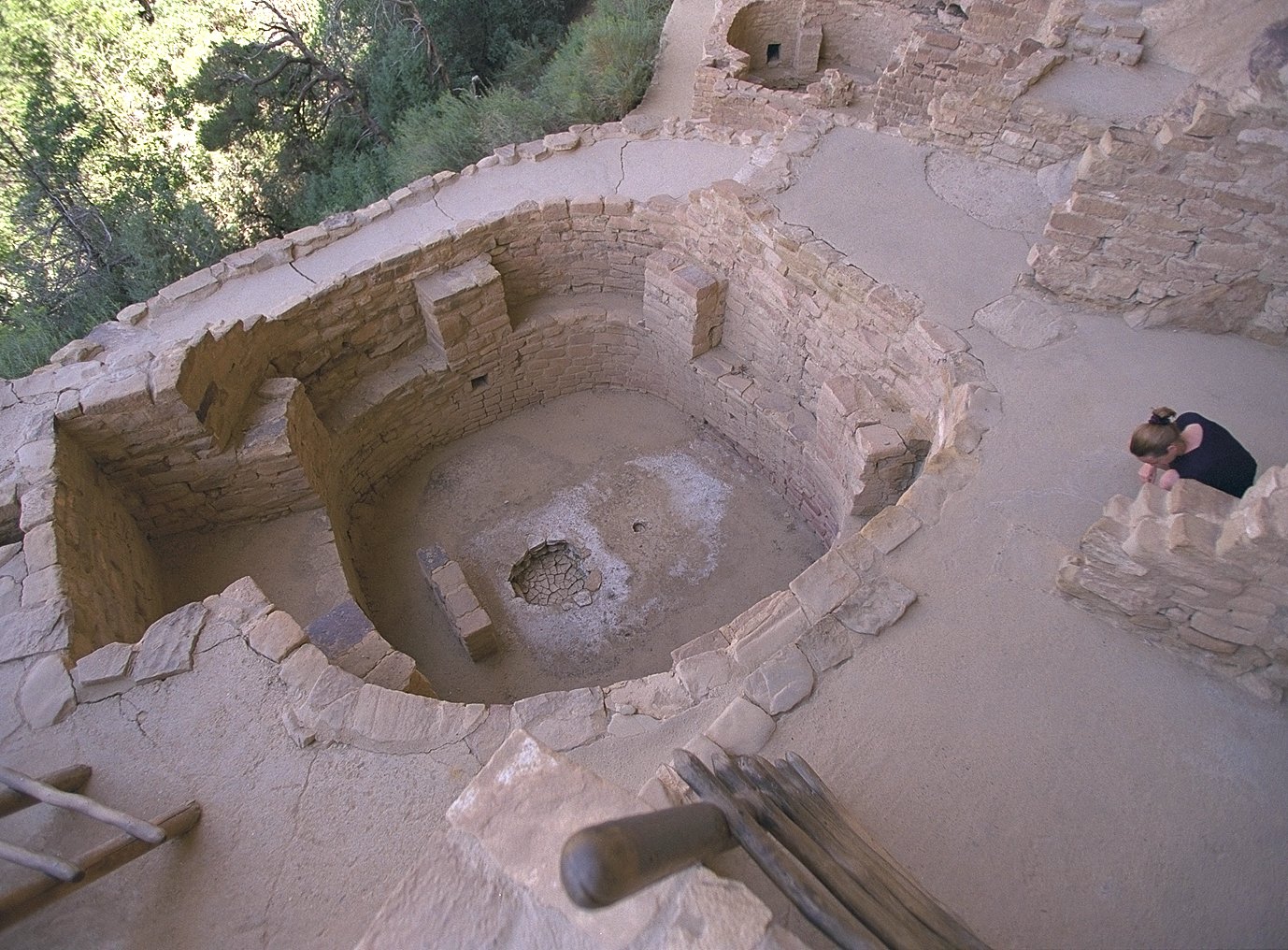
The reason for the T shape of the window in the tower (above) is unknown.
|
|
A civil engineer might say that the most impressive feat was filling and stabilizing the cliff edge in front of the buildings.

|
© 2000 Bruce Blankinship